Tarring

 Worthing Direct Leaflet Distribution Services

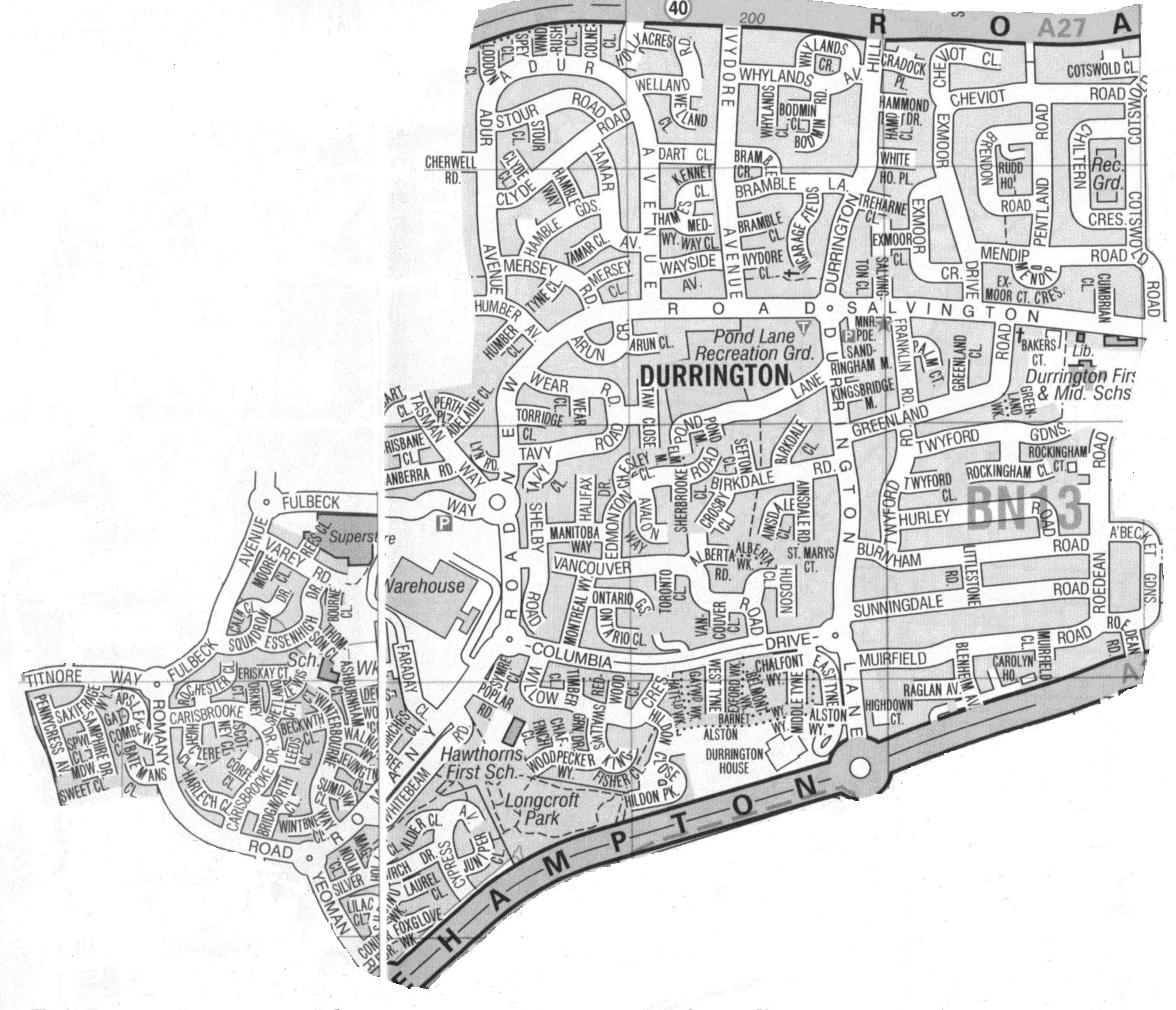
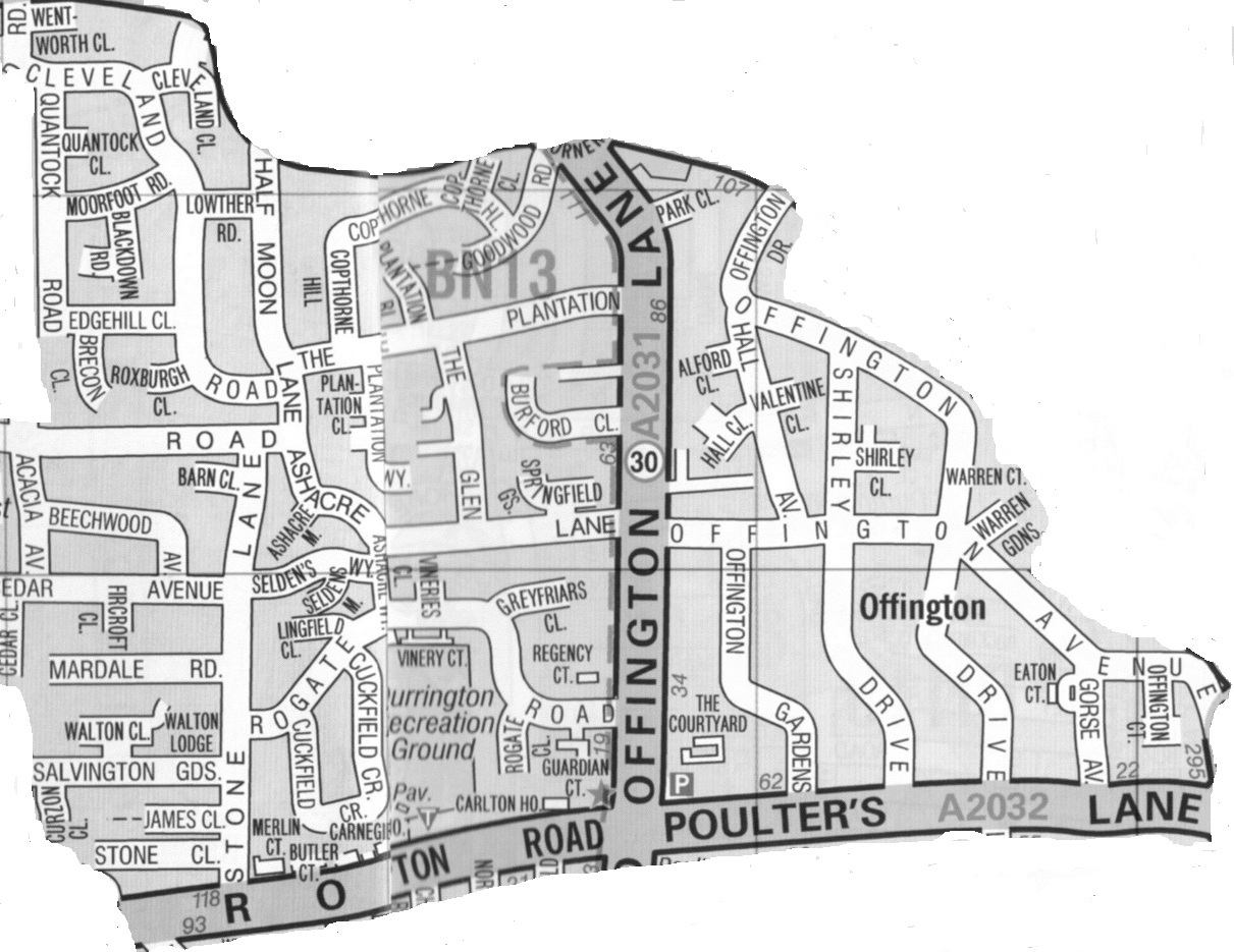
Tarring Area Delivery Map

 Leaflets & flyers are delivered to a total of 5,000 households in the Tarring area.

Worthing Direct Leaflet Distribution Services Tarring area delivery map


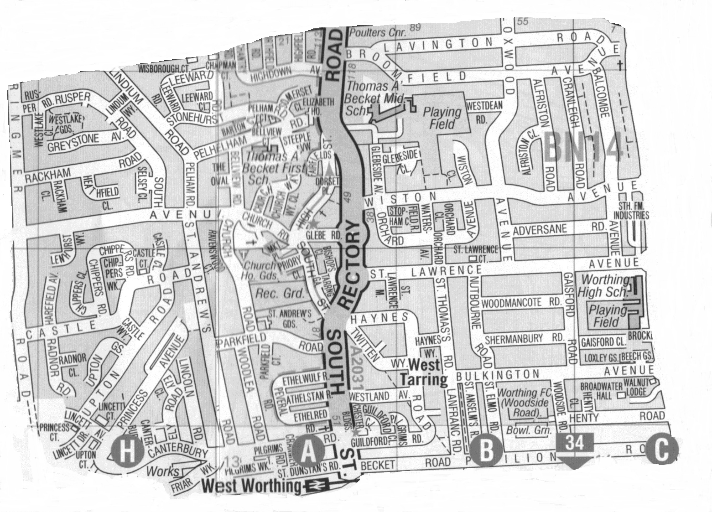
The Tarring delivery area sits in the middle of Worthing and is surrounded by several of our other delivery areas – Durrington & Offington to the north, West Worthing to the west, Broadwater to the east and Central Worthing to the south.

It is south of the A2032 (Littlehampton Road & Poulter’s Lane), north of the main railway line, east of South Farm Road, both Ringmer Road & George V Avenue are included on its eastern fringe, and it includes part of the A2031 (Rectory Road & South Street).

Durrington

 Worthing Direct Leaflet Distribution Services

Durrington Area Delivery Map

 Leaflets & flyers are delivered to a total of 5,000 households in the Durrington area.

Worthing Direct Leaflet Distribution Services Durrington area delivery map


The Durrington delivery area reaches to the north-western outskirts of Worthing, and is situated west of our Offington and north of our Goring-by-Sea delivery areas.

It is south of the A27 (Arundel Road) & north of the A259 (Littlehampton Road).

Offington

Worthing Direct Leaflet Distribution Services

Offington Area Delivery Map

Leaflets & flyers are delivered to a total of 2,000 households in the Offington area.


Worthing Direct Leaflet Distribution Services - Offington delivery area map


The Offington delivery area is in the north of Worthing, situated east of our Durrington and north of our Tarring delivery areas.

It is south of both the A27 (Crockhurst Hill) & the A24 (Warren Road), parts of both the A2031 (Offington Lane) & the A2032 (Littlehampton Road & Poulter’s Lane) fall within the area.